Two Maps of New Germany, New York State
Deux cartes de la Nouvelle Allemagne, ètat de New-York
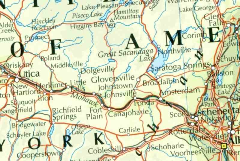
Map showing the area called "New Germany" within part of New York State
Carte de la rÕgion appelÕe "Nouvelle Allemagne" dans l'ètat de New-York
New Germany was the area on the Mohawk River around Herkimer and Little Falls, which is
just East of Utica on the Mohawk River, on the road to Albany:
La Nouvelle Allemagne Õtait la rÕgion autour de la Mohaw River autour de Herkimer and Little Falls,
just Á l'est de Utica, sur la route d'Albany:
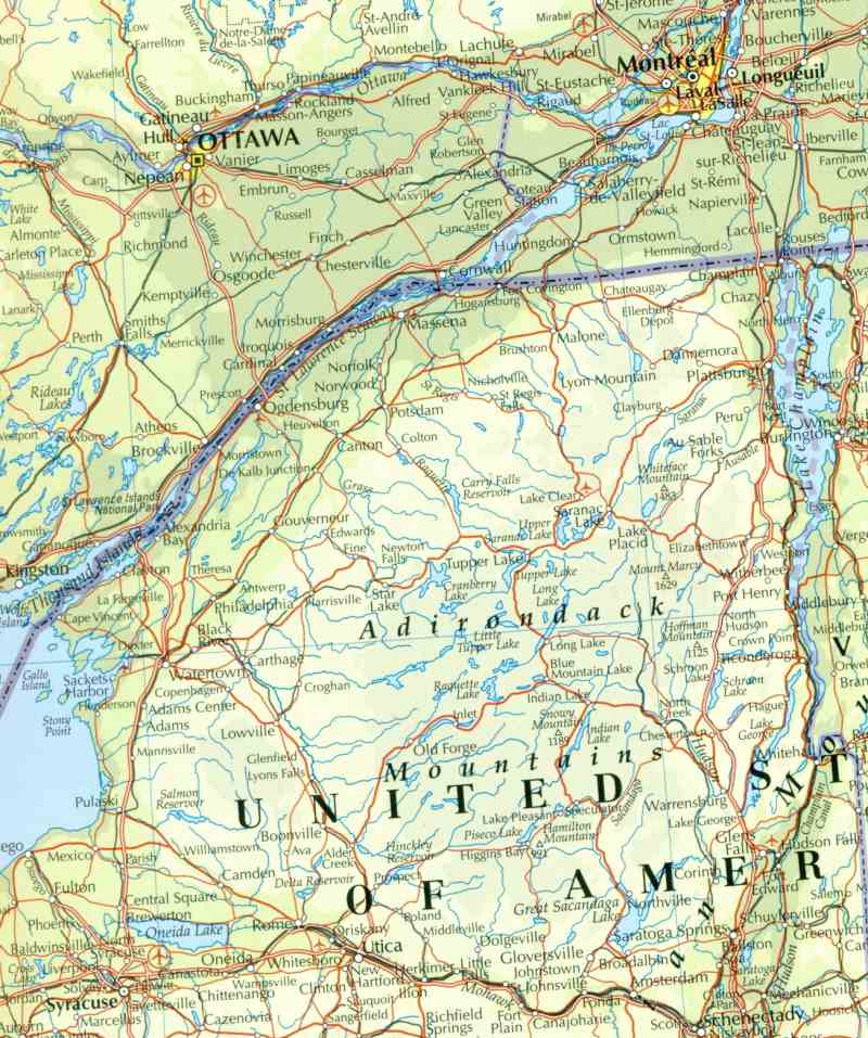
Map showing New Germany as well as part of New France
Carte de la Nouvelle Allemagne ainsi qu'une partie de la Nouvelle France
This map shows the way from "New Germany" to Fort Oswego, at the mouth of the Oswego river on lake Erie, and from Fort Oswego to the important New France settlement of Ville-Marie (MontrÕal) along the Saint-Lawrence River. New France went all the way to Detroit and beyond at that time. It seems that the French troops under Montcalm took Fort Oswego before the Fall of 1756, although the English forces were more numerous and had a stronger naval presence in the area.
The Lake of The Two Mountains is where the Ottawa River meets the Saint-Lawrence
River, just South West of Saint-Eustache, to be found West of MontrÕal, on the main land.
Ile Bizard is just South East of Saint-Eustache, and East of the Lake of The Two Maintains.